Last year when we were in Albuquerque, New Mexico we hiked up a hill to see some petroglyphs. The ranger said the trail was smooth and paved all the way to the top. This turned out not to be correct. Some places had handrails, some did not. With my acrophobia this sometimes is a problem. Usually if I have somewhere to hold on to I am OK.
When we got back to the bottom of the hill we met a nice older couple who had a real nice set of hiking poles. They shared with us that in situations that are severely uneven or rocky they really help balance, kind of like a portable handrail. We decided to purchase some.
We found that high quality ones were $75.00-80.00 each and are hand specific. You can buy them as pair for about $95.00-$100.00. Since I am a lefty and Patty is a righty that seemed like the way to go! I found that Black Diamond Trail Shock Trekking Poles were some of the best available and I found them mail order $80.00 for the pair delivered. They are fully adjustable so they work for both Patty and me.
 |
| Trail Shock Poles |
We had them sent to Crystal and James' house so we had not been able to use them yet.
On Thursday we went to the Palatki and Honanki Ruins.
The road to Palatki is about seven miles of washboard gravel. The views are spectacular!
 |
| Road to Palatki |
When you arrive there is a visitor center. They advise you to use walking sticks because the trail is very uneven. They even have loaner wooden sticks to use.
 |
| Palatki Ruins |
This was our chance to use our high tech ones for the first time.
 |
| Using the Trekking Poles |
There were two trails. One to the Ruins and one to the Pictographs. Combined they were about 1 1/2 miles total. The Ruins trail was rated as difficult and the Pictograph trail was easy.
 |
| Trail to the ruins |
Patty felt she could have made the trail without the poles but she would have been crawling on her knees. I don't believe I could have made it without them.
 |
| Trail to Palatki Ruins |
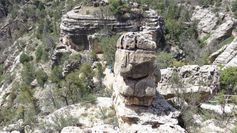
The thing is that you are on the side of a cliff. It so helped me to have something to steady myself with!
 |
| Trail |
We finally arrived at the ruins.
 |
| Careful - Unstable! |
It's pretty amazing that these still exist. These were not excavated but were found just as you see them. These as all the other dwellings are from the Sinagua Indians from 1100-1400 AD.
 |
| Palatki Dwelling |
This is the view the Sinagua had from their cliff dwelling! Beautifull!
 |
| Palatki View |
We headed back down the same trail. At the bottom there is a sign that directs you to the much easier Pictograph trail.
 |
| Pictograph Trail |
This cactus flower was on the Pictograph trail. Although it was still an uphill climb, it was pretty smooth and very easy to hike.
 |
| Blooming Cactus |
Here are the Palatki Pictographs. Earlier we showed you the V-Bar-V Petroglyphs. The difference is that the Pictographs are painted pictures and the Petroglyphs are chiseled pictures.
 |
| Palatki Pictographs |
We walked back down the trail and drove about 1 1/2 miles before taking a sharp right. The road got much narrower and windier. It also became much rockier. I would not want to take a car on this road. Five miles later we got to the Honanki Ruins site.
 |
| Honanki Ruin Site |
The trail was a 3/4 mile loop. Going to the ruins the trail was very easy.
 |
| Honanki Trail |
You could see the ruins from a distance. The trail would run right by the ruins and then circle back.
 |
| Honanki Ruins |
Most of the Sinagua Dwellings were built under rock overhangs. This one is no exception.
 |
| Ruins |
There were probably 20-30 different rooms here. It is amazing how much there is to see around the Cottonwood area!
 |
| Sinagua apartments |
On the way back down the trail got a little rough, but still nothing like Palatki. There were a few spots like you see below, but then it leveled out and it was good to go!
 |
| Honanki Trail |
On the way home we went by the Page Springs Fish Hatchery. They had this feeding pond.
 |
| Fish Hatchery |
On Friday we went to the Verde Valley County Fair in Cottonwood.
 |
| Verde Valley County Fair |
At 7:00 pm the Rodeo started. We got some good seats and enjoyed the show! The Rodeo in Arizona is Pro-God, Pro-American, and Pro-Republican! LOL
 |
| Rodeo |
The pride of the fair this year is that the ferris wheel is all lit up with LED lights!
 |
| Wahoo! |
Got to love a small town county fair!
Well that's it for today!
God Bless you,