Thursday, June 26, 2014

Colorado Springs, Co

We have Internet Service here so I am going to try and catch up the blog. I am as much as possible going to make each posting for each city we have visited as opposed to each day at the location.

Today's blog will be about Colorado Springs, Co. We stayed at  a Passport America park for three days right in the city of Colorado Springs. It was not a pretty park, but it did have a view of the city and it was very convenient to everything!

Foot of the Rockies RV Park
After going to the Unser Racing Museum in Albuquerque we knew we needed to go to Pikes Peak! It is a road that goes 14,110 feet up a mountain. On the way up we came to Crystal Reservoir. As you can see it had quite a photo opportunity! Yes we really took this picture!!

Crystal Reservoir
As you can see the road goes up past the tree line. There are no guard rails and it is kind of nerve racking driving up this road.
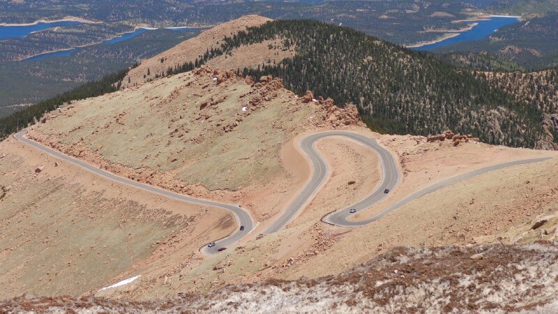
Road to Pikes Peak
You know you are getting up in the sky when you look down on the clouds!

Above the clouds
Here we are in June and there was still a lake with ice on it. We never drove by it, but could see it from the summit of Pikes Peak.

Iced Lake
You can either drive the road to the summit or take a tram. We heard many people complaining that they were getting light headed or sick from the altitude. We think we are doing OK because we have been in altitude of over a mile high for several weeks now. They do recommend that you only stay at the summit for 1/2 an hour or so because of the altitude. We stayed for about an hour and felt good.

Pikes Peak
We headed back down the mountain. Because diesel trucks free wheel and don't have any engine compression when idling I stuck the tranny in second gear and took my time going down. I saw others riding their brakes the whole way down! STUPID!

Road Down
About half way down there is a mandatory brake check station. They use a temperature gun and check your brakes. If they are hot they make you pull over to cool off. Everyone we saw was made to pull over with their hoods up for airflow. We came up to the checkpoint and I said to the Ranger that I would be surprised if our brakes were hot. He checked them and said, you're right, they are cool. He suggested we keep it up for the next four miles, but keep on, no need to stop.

Brake Checkpoint
after Pikes Peak we went to Garden of the Gods. This is a city park in Colorado Springs that has some spectacular rock formations.

Garden of the Gods
There are roads throughout the park, or there are hiking trails you can hike on.

GOTG City Park
This rock looked like it was ready to fall, so I decided to help hold it up!

Balancing Rock
The next day we went to the USA Olympic Training Complex. The do hourly tours of the complex. There are over 100 athletes that live here full time and make training for the Olympics their full time jobs!

USA Olympic Training Complex
Here we are in front of the training center. 

USA Selfie!
The tour took us through many aspects of the training including shooting, wrestling, weightlifting, swimming and basketball.
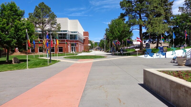
Training Village
Here are some of the athletes doing some weightlifting.

Weightlifting
There were some athletes doing laps in the pool when we were here.

Olympic Pool
This is the closest we will get to the medal stand! But the tour was worth doing.

USA! USA! USA!
We enjoyed our time in Colorado Springs. Next stop is Loveland, Co. 

Thank you for reading and God Bless!

Brian and Patty


Monday, June 16, 2014

Bandelier National Monument

On Thursday June 29th we drove to Bandelier National Monument. The sad thing is that although it is about 10 miles away from our campsite at Cochiti Lake "as the crow flies", as the road goes it is about 70 miles!

Bandelier National Monument
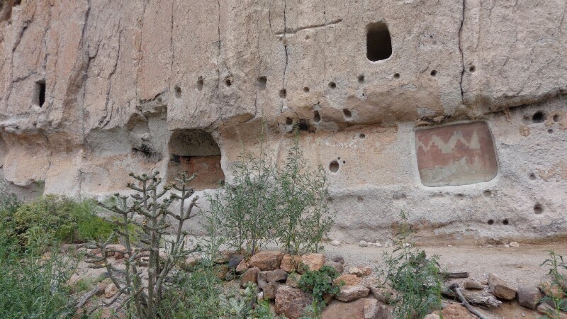
What is unique about Bandelier is that the cliff dwellings are accessible to the public via wooden ladders. Here are some ruins that are not up on the cliffs.

Indian Ruins
On the hill behind you can see holes in the wall that are the cliff dwellings.
Cliff Dwellings
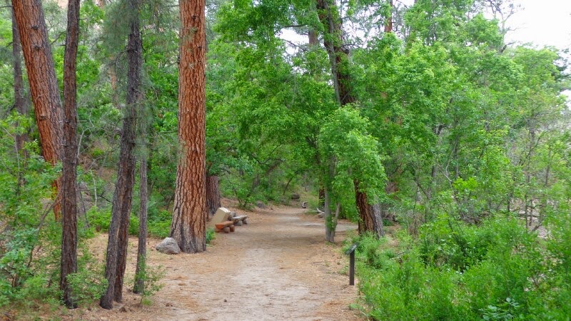
This is the trail that leads you to the cliff dwellings.

Trail to the cliffs
They have signs telling you to stay on the trail and only enter the dwellings that have ladders leading to them. That was not a problem for us! :)

Stay on the trail
The trail led all over the rocks. You can see the steps in between the two rocks in the top right corner of the picture.

Trail
Here we are taking a selfie at one of the ladders. As you can see someone 'photo bombed' our photo! Lol!

Selfie at the ladders
Here are some people getting ready to climb one of the ladders to go in a dwelling.

People climbing ladders
Here I am getting ready to enter one of the dwellings.

Going in Cave
Patty said she took this picture to prove that I actually climbed up the cliff and then went up the ladder because I'm so acrophobic. I hope she doesn't use this against me when we go back home and put Christmas lights up.
.
Brian in the Cave
Here is a shot of the lower ruins from on the cliffs.

Indian Village
Patty also went into the Caves, but she has no fear!!
Patty in the Cave
Here are some pictographs. The one on the right had a plexiglass sheet over it to protect it from weather and vandalism.

Pictographs
Continuing the loop we had to cross the stream. Last year there was a lot of flood damage here and the walking bridge was wiped out. This is what they have placed over the stream for now.

Plank Bridge
After crossing the "Bridge", the ecosystem changed completely from an arid dry New Mexico looking climate to a green Oregon looking trail. It was amazing the difference!

Looks like Oregon
On the 31st we left Cochiti and drove North to Raton Pass which is about 50 feet from the Colorado State line. We stayed at the Cedar Rail RV Park.

Cedar Rail RV Park
That afternoon it started clouding up. It was quite a beautiful scene.

Clouds
Then the skies opened up! It started raining and thunder and lightning! The rain turned into hail! Fortunately it was just pea size and did not cause any damage.

Hail
The next morning we headed into Colorado. We will update as we have Internet connections!

God Bless,
Brian and Patty


Wednesday, June 11, 2014

Santa Fe, Nm

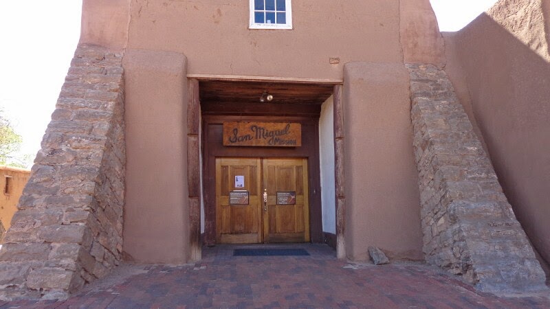
On Wednesday May 28th we drove into Santa Fe for the day. We first went to the Mission San Miguel. This is the oldest church in the United States built in 1610.

San Miguel Church
I had always assumed that the oldest church would have been in one of the 13 colonies, but this church out dates them. 

San Miguel Exterior
The church has been re-stuccoed, but the original is still intact. Towards the front of the church there are some cutouts that you can see the original stucco.

San Miguel Interior
We parked the truck in the Old Town area and did a walking tour based upon a walking tour map we received from the visitor center. One of the areas was suggested to go was Canyon Road. It is an artsy area where every house and shop on the street and surrounding streets are art galleries. 

Canyon Road
Mostly they are sculptures and bronzes and things like that. Some are pretty good, some are pretty weird!

Sculptures and things
We didn't see anyone shopping but there were other people like us walking around looking. They must be selling this stuff though because there are so many shops!

Gallery
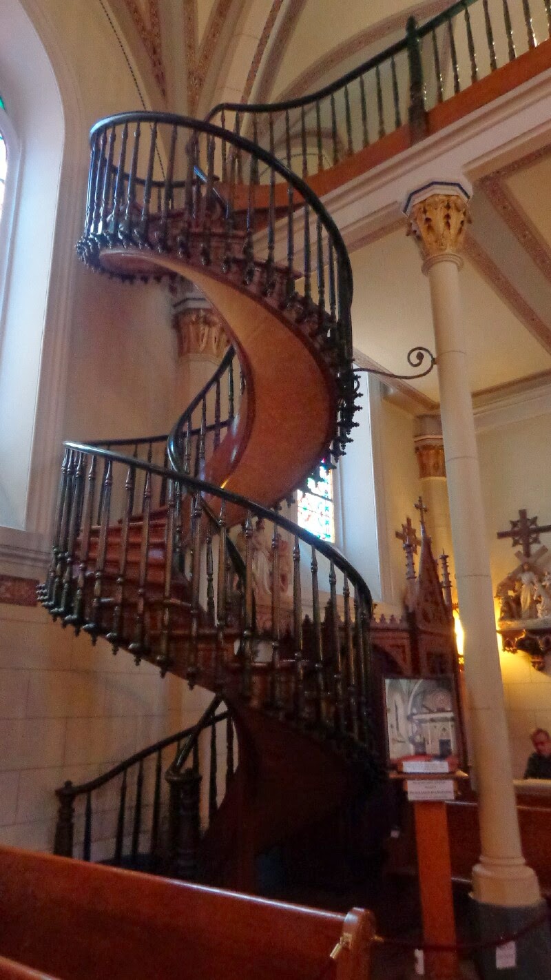
After Canyon Road we went to the Loretto Chapel. There is supposed to be a "Miraculous Stairway" here.

Loretto Chapel
The story of the chapel and stairway is supposed to be as follows:

In 1872 Jean-Baptiste Lamy, the Bishop of the Santa Fe Archdiocese, commissioned the building of a convent chapel to be named Our Lady of Light Chapel, which would be in the care of the Sisters of Loretto. The chapel was designed by French architect Antoine Mouly in the Gothic Revival style, complete with spires, buttresses, and stained glass windows imported from France. Although it was built on a much smaller scale, the chapel bears an obvious resemblance to the Sainte-Chapelle in Paris.

The architect died suddenly and it was only after much of the chapel was constructed that the builders realized it was lacking any type of stairway to the choir loft. Due to the chapel's small size, a standard staircase would have been too large. Historians have also noted that earlier churches of the period had ladders rather than stairs to the choir loft, but the Sisters did not feel comfortable with that prospect because of the long habits that they wore.

The Sisters of Loretto relate the story as follows:

Needing a way to get up to the choir loft the nuns prayed for St. Joseph's intercession for nine straight days. On the day after their novena ended a shabby-looking stranger appeared at their door. He told the nuns he would build them a staircase but that he needed total privacy and locked himself in the chapel for three months. He used a small number of primitive tools including a square, a saw and some warm water and constructed a spiral staircase entirely of non-native wood. The identity of the carpenter is not known for as soon as the staircase was finally finished he was gone. Many witnesses, upon seeing the staircase, feel it was constructed by St. Joseph himself, as a miraculous occurrence.

The resulting staircase is an impressive work of carpentry. It ascends twenty feet, making two complete revolutions up to the choir loft without the use of nails or apparent center support. It has been surmised that the central spiral of the staircase is narrow enough to serve as a central beam. Nonetheless there was no attachment unto any wall or pole in the original stairway, although in 1887 -- 10 years after it was built -- a railing was added and the outer spiral was fastened to an adjacent pillar. Instead of metal nails, the staircase was constructed using dowels or wooden pegs.

Here is the staircase, you can decide for yourself!

Loretto Staircase
Sante Fe is the capital of New Mexico. We decided to take a tour of the capital building.

State Capital
You check in at the front desk and they give you a self guided tour brochure. You pretty much can go anywhere you want to in the building! Quite a bit different then in California!

We found the Governor's Office right away. She is Republican Susana Martinez. Apparently she is a great governor with a 66 percent approval rating. We walked right in and her staff was really friendly and was really enthusiastic about serving with her!

Governor's Office
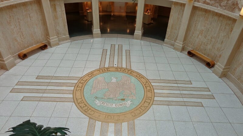
This is the state seal of New Mexico. "Crescit Enudo", It Grows as it Goes!

Crescit Enudo
We had a great day in Santa Fe. What great history this old town has! Tomorrow we will go to Bandelier National Monument and climb ladders into the cliff dwellings. Pray for me with my fear of heights! LOL!!

Love you all!

Brian and Patty


Monday, June 09, 2014

Cochiti Lake, NM

We left Albuquerque and headed about 60 miles up Interstate 25 to an Army Core of Engineers campground at Cochiti Lake.

Cochiti Lake
For only $10.00 a night it had 50 amp electricity and water but no sewer, but an incredible view of the lake! We were very careful with our water and sewer and we were able to last 5 nights. we were in site # 63. We would really like to come back to this GREAT campground!

Campsite #63
Tuesday we drove to the Tent Rocks National Monument. Tent Rocks is only about 6 miles from Cochiti lake.
Tent Rocks National Monument
There are two hikes at Tent Rocks. The easy one is the Cave Loop Trail and runs right through the Tent Rocks. The harder Canyon Trail runs through a slot canyon and eventually makes you do some rock climbing to get to an overview. The best part of the Canyon Trail though is through the slot canyon.

Two Trails
The Canyon Trail is in and out. When you are about half a mile from being out you can take a right turn and complete the Cave loop.

Canyon Trail
We started on the Canyon Loop. We passed the intersection of the Cave loop and continued towards the slot canyon.

Start of the slot canyon
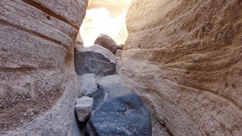
Several places in the canyon the canyon narrows to where only one person at a time can pass.There are even some places that you have to 'tightrope' walk, one foot in front of another.

Slot Canyon Narrows
The trail started getting tougher with rocks and boulders, but the canyon is really beautiful with its smooth and flowing walls.

rough trail
Not only did you have to climb over rocks, but there were boulders that you had to go under. This is really a neat trail!

Big Boulders
We made it out of the slot canyon and continued up the trail.

Out of the canyon
We just had climbed a very tough area that was about a 20 foot rock climb. At this point we had seen the best of the Canyon Trail hike. As we looked up the hill it was single track and most people were getting on all fours in many spots. We decided we had completed our trail segment!

Trail really got rough
It is reported that after visiting Tent Rocks Dr. Seuss was inspired to model Whoville after it. It doesn't take much imagination to see it!

Whoville?
If ever you are in the Santa Fe or even Albuquerque area you MUST hike the Tent Rocks area. It is an amazing hike!

Tent Rocks Selfie
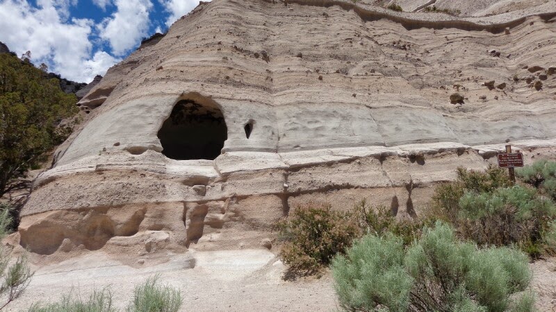
We headed back down the Canyon Trail and the Slot Canyon was just as wonderful in reverse! When we got to the Cave Trail intersection we opted to take the Cave Trail back to the parking area. Here is the Cave.

Cave
What we were not aware of is that the Cave Trail winds back down a ridge and through a different set of Tent Rocks! You can see them in the distance.

Tents
The trail goes right between the Tent Rocks.

Trail through the Tents
Because we did not hike to the overlook we found one we could drive to. Quite a view!

Tent Rocks Overlook
Well that's it for today! It was almost 90 degrees out so we are tired! Tomorrow we will go to Santa Fe.

God Bless you,

God is SO GOOD!

Brian and Patty