First let me tell you that we are about two months behind on our blog. The dates that are showing up are not actually correct. Sorry about that. We went for awhile without good fast Internet which kept us from being able to update.
_________________________________________________________________________
We are heading to Leadville, Colorado. Leadville is the highest incorporated municipality in the USA at 10,200 feet above sea level! To put that in perspective, Denver is called the mile high city, this is almost two miles high!!!!!
We went through the Eisenhower tunnel on the I70. This tunnel is 1.693 miles long! It is the second time we have gone through this tunnel, but the first time with our 5th wheel.
 |
| Eisenhower Tunnel |
The first time was when we picked up our 5th wheel on our way to Michigan in 2011. That was also in June and also had snow on the ground.
 |
| Inside the Tunnel |
We stayed at the Leadville RV Park. It was a Passport America park so we got in for 1/2 price. That is always nice. This park only lets you stay for a few days which worked for us. After meeting the owner he said next time he would waive the rule if I come back. That was nice of him.
 |
| Leadville RV Park |
Our great friends Bill and Jenn Gehr told of of a place to eat here called Quincy's Steak house.
 |
| Quincy's Steakhouse |
On Sunday through Thursday they serve one thing, and one thing only, Filet Minion! Want some Chicken, too bad! Want some Prime Rib, too bad! Want some Bacon wrapped Filet Minion? This is the place for you!!! Comes with diner salad, baked potato, veggie and bread. How much you ask?
$9.95!
It's a bargain! And it awesome! In fact it's so good we ate here twice in the four days we were here!
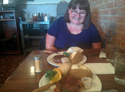 |
| Filet Minion |
Friday and Saturday they also serve Prime Rib and Rib Eye Steak. But that's it. The Hostess warns you before they sit you that if you don't want beef this is not the place for you. LOL. My kind of place!
We were told be should go the Independence Pass to Aspen, Co. It is mostly a beautiful road with two horrible tight spots that two mini-cars can't pass through!
This is the continental divide at the summit. Notice the elevation is 12,095 feet!
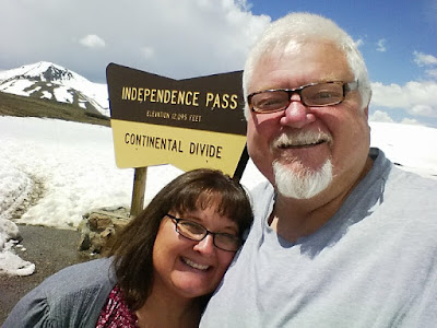 |
| Continental Divide |
We saw forests and snow along the road!
 |
| Snow Next to Road |
Even waterfalls!
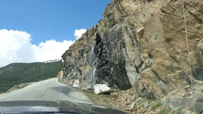 |
| Waterfall |
The road was quite curvey. With lots of hairpin turns!
 |
| Lots of Hairpin turns |
And there were two spots in particular that were very narrow!
 |
| Narrow road |
My truck is not 8' 1" wide. If you notice this rock on the right is sticking out over the road. At this point we were already here a car comes rushing on us from the other side. We tried to get him to stop since we were already here. He said "We can both make it". I said, well I'm not getting closer to the rocks, as I was already about 2" away from them. If you want to go off the cliff or scrape the guard rail, as long as you don't touch my truck it's up to you, but I'm not moving!!! You should back out of my way. Somehow he got by me, and I don't think he scraped his car on the guardrail.
This is our picture above. Obviously we didn't take any pictures while this was happening. Also immediately a girl tried to do the same thing, but Patty stuck her hand out the sun roof and got her to back up.
The following picture I found on the Internet. It shows how really tight it really is for even small cars! Can you imagine my 8'1" wide truck and someone squirting by me? I guess you truly can't fix STOOOPID!
 |
| Crazy tight road! |
We made it to Aspen. Here is a pic Patty took of the Ski Lifts. We did go into a grocery store and drove around town, but we really weren't too impressed with Aspen. Just a bunch of overpriced stores.
 |
| Aspen Ski Lifts |
We headed back on the Pass. Fortunately we didn't run across anybody on the tight spots this time. We stopped at Twin lakes on the way back. Took a panoramic of the lake and I thought the picture came out nice.
 |
| Twin Lakes Pano |
That's it for Leadville. Next stop is Gunnison, Co.
Please pray for Avery Huffman!
Love you,